null

Categories

Site Information

 Loading... Please wait...
  • Facebook LinkedIn Twitter YouTube News
  • Call us 724-266-1600
  • My Account

News

"The Quest for the Highest Point"

"Determining the #elevation of the world''s most famous mountain is not as simple as taking a #GNSSReceiver to the summit...""The Quest for the Highest Point"Read: http://bit.ly/3ucBcIv#PLI #Geospatial #GeospatialLife #GeospatialData #Trimble #TrimbleGeospatial #Surveying #Surveyor #Surveyors #LandSurvey #LandSurveyor #LandSurveyors #LandSurveying #GPS #GNSS #Geodesy #Everest #NSPS #PSLS #PLSO #WVSPS #PA #OH #WV

Read More »


Trimble Access 2021.00 is Now Available!

#Trimble Access 2021.00 is Now Available!Release Notes: http://bit.ly/37u0kkl#PLI #Geospatial #TrimbleGeospatial #GeospatialLife #GeospatialData #Surveying #Surveyor #Surveyors #SurveyLife #LandSurvey #LandSurveyor #LandSurveyors #LandSurveying #NSPS #PSLS #PLSO #WVSPS #PA #OH #WV

Read More »


Experience Next-Generation Productivity with the Trimble SX12 3D Scanning Robotic Total Station!

"Aim, measure & mark effortlessly! The #TrimbleSX12's green, focusable laser pointer yields the smallest spot size in the industry, just 6mm at 100m, letting you work from longer range!"Learn More & Schedule a Demo!http://bit.ly/2NlBj3R724-266-1600 | PLI@laserinst.com#PLI #Geospatial #Trimble #TrimbleGeospatial #GeospatialLife #GeospatialData #Surveying #Surveyor #Surveyors #SurveyLife #LandSurvey #LandSurveyor #LandSurveyors #LandSurveying #3DScanning #3DScanner #3DLaserScanning #TotalStation #EngineeringLife #ConstructionLife #NSPS [...]

Read More »


"Geodesia Today: RTK Radio Secrets - Part 1"

"Real-Time Kinematic (#RTK) #GPS #Surveying is great, but one of the biggest challenges in the field is having sufficient #UHF radio range between base & rover...""#Geodesia Today: RTK Radio Secrets - Part 1"Read: http://bit.ly/3jWmgcGShop Online & Schedule a Local Solutions Demo!https://www.laserinst.com/contact724-266-1600 | PLI@laserinst.com#PLI #Geospatial #Trimble #GeospatialLife #GeospatialData #Surveyor #Surveyors #SurveyLife #LandSurvey #LandSurveyor #LandSurveyors #LandSurveying #VRS #RTN #GNSS [...]

Read More »


Introducing the Trimble SX12 3D Scanning Robotic Total Station!

The NEW #TrimbleSX12 #3DScanning #Robotic #TotalStation is built for seamless workflow integration & better, faster results in every field!Learn More & Schedule a Local Demo!https://bit.ly/3qsWhfx724-266-1600 | PLI@laserinst.com#PLI #Geospatial #Trimble #TrimbleGeospatial #GeospatialLife #GeospatialData #Surveying #Surveyor #Surveyors #SurveyLife #LandSurvey #LandSurveyor #LandSurveyors #LandSurveying #Construction #ConstructionLife #EngineeringLife #NSPS #PSLS #PLSO #WVSPS #PA #OH #WV

Read More »


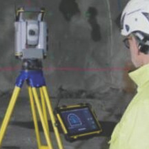
"Tunnel Surveying, Improved: Digging into the Trimble SX10, Trimble Access, and TBC!"

Upcoming Webinar: "Tunnel Surveying, Improved: Digging into the Trimble SX10, Trimble Access & TBC!"Wednesday, February 24th, 2021 | 11:30am ESTLearn More & Register: https://bit.ly/2OxIVAmSchedule a Local Solutions Demo!https://www.laserinst.com/contact724-266-1600 | PLI@laserinst.com#PLI #Geospatial #GeospatialLife #GeospatialData #Surveyor #Surveyors #SurveyLife #Tunneling #TunnelSurvey #TunnelSurveying #EngineeringLife #Engineering #CivilEngineering #Construction #ConstructionSurvey #Tunnels #NSPS #PSLS #PLSO #WVSPS #3DScanning #PA #OH #WV

Read More »


Take a Look at This Overview of Trimble Geospatial Product Updates for TBC, Access, INPHO & eCognition!

Take a Look at This Overview of #Trimble #Geospatial Product Updates for #TBC, Access, INPHO & eCognition!Learn More: http://bit.ly/3jLCSnCSchedule a Local Solutions Demo!https://www.laserinst.com724-266-1600 | PLI@laserinst.com#PLI #GeospatialData #GeospatialLife #TrimbleGeospatial #Surveying #Surveyor #Surveyors #SurveyLife #LandSurvey #LandSurveying #LandSurveyor #LandSurveyors #GIS #GPS #GNSS #Mapping #URISA #NSPS #PSLS #PLSO #WVSPS #PA #OH #WV

Read More »


Support Guide: "Ohio VRS Survey Style Settings for GNSS Signal Tracking"

Checkout Our Helpful Support Guide:"#Ohio #VRS #Survey Style Settings for #GNSS Signal Tracking"Download: https://bit.ly/3rMF5Sa#PLI #Geospatial #Trimble #TrimbleGeospatial #GeospatialLife #GeospatialData #Surveying #Surveyor #Surveyors #SurveyLife #LandSurvey #LandSurveyor #LandSurveyors #LandSurveying #GPS #GIS #Mapping #NSPS #PSLS #PLSO #WVSPS #PA #OH #WV

Read More »


Fast High-Accuracy Mapping for Gas Pipelines!

"SUBURBAN CONSULTING ENGINEERS, INC., (SCE) utilizes #GIS technologies – including the #Trimble #R2 #GNSS with #TDC600 data collectors running #Esri #ArcGIS Collector software – for fast, high-accuracy #mapping for #gas #pipelines."Learn More: http://bit.ly/3aXgnI6Schedule a Local Solutions Demo!https://www.laserinst.com/locate-mapping-products724-266-1600 | PLI@laserinst.com#PLI #Geospatial #GeospatialData #Surveying #Surveyor #Surveyors #SurveyLife #GPS #URISA #AssetTracking #NSPS #PSLS #PLSO #WVSPS #PA #OH #WV #UtilityMapping #EngineeringLife

Read More »


Have You Seen the Trimble Business Center Tips Blog? Check It Out!

Have you seen the #Trimble #TBC Tips Blog? "See all the latest tips to this powerful software, including new tips such as importing newer VCE files into older TBC versions, sample datasets & the new Filter Station Scan Points Command!"Learn More: http://bit.ly/3tDOFIRSchedule a Local Solutions Demo!https://www.laserinst.com/contact724-266-1600 | PLI@laserinst.com#PLI #Geospatial #GeospatialLife #GeospatialData #Surveying #Surveyor #Surveyors #SurveyLife #LandSurvey [...]

Read More »