null

Categories

Site Information

 Loading... Please wait...
  • Facebook LinkedIn Twitter YouTube News
  • Call us 724-266-1600
  • My Account

News

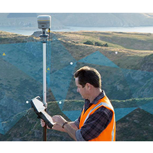
"Increasing Accuracy on Power Line Surveys!"

"An 8,000-square-mile remote, precise #GNSS survey without a base or network? Read about the success of a 3-week #powerline #mapping project using #Trimble CenterPoint #RTX!"Read: https://bit.ly/2Ske4tv#PLI #Geospatial #GeospatialLife #GeospatialData #Surveying #Surveyor #Surveyors #SurveyLife #LandSurvey #LandSurveyor #LandSurveyors #LandSurveying #GNSSReceiver #RTN #VRS #GPS #GIS #Powerlines #Utilities #Infrastructure #Geomatics #NSPS #PSLS #PLSO #WVSPS

Read More »


Tunnel Monitoring in the Netherlands

Read how the #TrimbleS9 Automated Motorized #TotalStation (AMTS) was used to efficiently #monitor #tunnel #construction on The Rotterdamsebaan tunnel beneath The Hague!Read On: https://bit.ly/3oRbGq2#PLI #Geospatial #Trimble #TrimbleGeospatial #GeospatialLife #GeospatialData #Surveying #Surveyor #Surveyors #SurveyLife #MonitoringSystem #MonitoringServices #MonitoringandEvaluation #Tunneling #ConstructionSurvey #ConstructionLife #EngineeringLife #NSPS #PSLS #PLSO #WVSPS

Read More »


See Us LIVE with the Trimble R12i @ the PSLS Southwest Chapter Meeting!

See us LIVE & IN-PERSON with the #TrimbleR12i this Wednesday, May 19th, 2021 for the #PSLS Southwest Chapter Meeting!Learn More: https://www.psls.org/event-4298938Schedule a Local Demo!https://www.laserinst.com/trimble-r12i-gnss-system724-266-1600 | PLI@laserinst.com#PLI #Geospatial #Trimble #TrimbleGeospatial #GeospatialLife #GeospatialData #Surveying #Surveyor #Surveyors #SurveyLife #LandSurvey #LandSurveyor #LandSurveyors #LandSurveying #PASurveyor #PASurveyors #PA #R12i #GNSS #GNSSReceiver

Read More »


"Upgrade Your Tunnel Surveys with Trimble & Amberg!"

Webinar: "Upgrade Your #Tunnel Surveys with #Trimble & #Amberg!"Thursday, May 20th, 2021 | 10am EDTLearn More & Register: https://bit.ly/3tEr2ip#PLI #Geospatial #GeospatialLife #GeospatialData #Surveying #Surveyor #Surveyors #SurveyLife #LandSurvey #LandSurveyor #LandSurveyors #LandSurveying #Tunnels #Tunnelling #TunnelSurveying #TunnelConstruction #ConstructionSurvey #ConstructionSurveying #NSPS #PSLS #PLSO #WVSPS #PA #OH #WV

Read More »


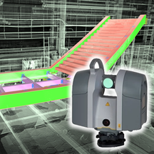
"Trimble Expands Surveying, 3D Modeling Capabilities with the Trimble SX12 3D Scanning Total Station!"

"#Trimble Expands #Surveying, #3DModeling Capabilities with the #TrimbleSX12 #3DScanning #TotalStation!"Read On: https://bit.ly/3nq47pmLearn More & Schedule a Local Demo!https://bit.ly/2NlBj3R724-266-1600 | PLI@laserinst.com#PLI #Geospatial #TrimbleGeospatial #GeospatialLife #GeospatialData #Surveyor #Surveyors #LandSurvey #LandSurveyors #LandSurveyor #LandSurveying #3DScanners #Tunneling #Construction #ConstructionSurvey #Mining #Drilling #Excavating #NSPS #PSLS #PLSO #WVSPS

Read More »


"Trimble RTX Correction Services Explained!"

"#Satellite & #cellular coverage make #Trimble's CenterPoint #RTX corrections available worldwide! Whether you're in a remote location or working over large geographic areas, you can survey anywhere!" Learn More: https://youtu.be/k4WBAHKyoI4#PLI #Geospatial #GeospatialLife #GeospatialData #Surveying #Surveyor #Surveyors #SurveyLife #LandSurvey #LandSurveying #LandSurveyor #LandSurveyors #GPS #GIS #Mapping #GNSS #GNSSReceiver #VRS #RTK #NSPS #PSLS #PLSO #WVSPS #PA #OH #WV

Read More »


Trimble SX12 Simple Survey Dataset!

"This #Trimble Business Center project highlights the capabilities of the #TrimbleSX12 #3DScanning #TotalStation. It was captured in just over an hour, with two instrument stations setup via resection from #GNSS points using a #TrimbleR12i #GNSSReceiver & #VRS network connectivity!"Check it out! https://bit.ly/3emdvGCLearn More & Schedule a Local Demo!https://www.laserinst.com724-266-1600 | PLI@laserinst.com#PLI #Geospatial #GeospatialLife #GeospatialData #Surveying #Suveyor #Surveyors #SurveyLife [...]

Read More »


"Automating Data Collection for Manual Monitoring"

"Automated #datacollection can vastly improve efficiency for survey #monitoring critical #infrastructure."Checkout the benefits & workflows of in this #Trimble blog!https://bit.ly/3xaLv1hSchedule a Local Solutions Demo!724-266-1600 | PLI@laserinst.com#PLI #Geospatial #GeospatialLife #GeospatialData #Surveying #Surveyor #Surveyors #SurveyLife #LandSurvey #LandSurveyor #LandSurveyors #LandSurveying #Monitor #MonitoringandEvaluation #Deformation #EngineeringLife #Construction #ConstructionLife #NSPS #PSLS #PLSO #WVSPS #PA #OH #WV

Read More »


Trimble Blog Series Part 4: "Coordinate Systems in GIS Workflows!"

Checkout Part 4 of #Trimble's blog series on "Coordinate Systems in Trimble GIS Workflows!"Read how geodetics come into play with different #GNSS correction sources: https://bit.ly/3dmtbdK#PLI #Geospatial #TrimbleGeospatial #GeospatialLife #GeospatialData #Surveying #Surveyor #Surveyors #SurveyLife #LandSurvey #LandSurveying #LandSurveyor #LandSurveyors #GNSSReceiver #GNSSRTK #Geodetic #GeodeticEngineer #Geodesy #Cartography #Cartographer #URISA #NSPS #PSLS #PLSO #WVSPS

Read More »


Introducing the Trimble T100 Rugged Surveying & GIS/Mapping Field Tablet!

"Introducing the #TrimbleT100, the latest high-performance, rugged field tablet for #surveying, #GIS & #mapping applications!This rugged tablet has a 10-inch, sunlight-readable touchscreen & is powered by a Windows 10 OS & Intel i5 processor for fast #datacollection, processing & #qualityassurance in the field!The T100 supports the full suite of workflows for #optical #GNSS & #laserscanning [...]

Read More »