Posted by Precision Laser & Instrument, Inc. on 30th Apr 2025
Why Connect GIS Databases in TBC?
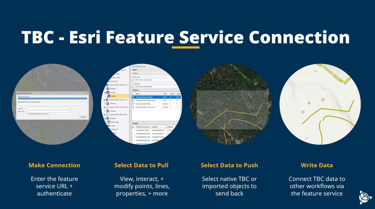
"Why Connect #GIS Databases in #TBC?
TBC Gives #Surveying Teams the Confidence to Manage & Analyze #GeospatialData w/ Ease - Bringing in, Editing & Sharing Data From Multiple Sources:
1) Streamlined Workflow w/ Live Data Links!
2) Efficient Handling of Constantly Updated or Large Datasets!
3) Connect to Various GIS Databases Like Shapefiles, File & Enterprise Geodatabases, Postgres Databases & #Esri Services!
4) Edit & Create Features Directly in TBC, Then Write Your Changes Back to the GIS Database!
Setting Up a Connection is Simple: Know Your Project Location & Coordinate System. Gather Connection Details (URL, Username, Password). Identify the Data You Need.
Use the GIS Connection Manager in TBC to Establish Your Connection & Start Reading Data w/ Options Like Window, Layer, Polygon & Attribute Filters."
#PLI #Trimble #TrimbleBusinessCenter #Geospatial #GeospatialLife #GeospatialTech #GeospatialTechnology #GeospatialSolutions #GeospatialAnalysis #SurveyLife #Surveyor #Surveyors #LandSurvey #LandSurveying #LandSurveyor #LandSurveyors #SurveyingSoftware #SurveyingTechnology #GPS #GNSS #Mapping #EngineeringLife #NSPS #PLS